blah blah blah
Kiah Pond
Length: 1.8 miles out-and-backDifficulty (click for info): Beginner
Elevation Gain: 150 feet (+30 feet on return)
Rating (click for info): 5/10
Elevation: 1436'
Driving Directions:
Trailhead and parking area are on Sandwich Notch Road in Sandwich, NH. (Seasonal road - check status on TrailsNH to verify gate status). From the center of Sandwich at the junction of Rt. 113 and Rt. 109, drive northwest on Grove Street, which becomes Diamond Ledge Road. In 1.9 miles, take a left at the T-junction onto Sandwich Notch Road. In 0.1 miles, bear left to stay on this road, passing through the seasonal gate. Drive 3 miles up the narrow, rough, and hilly road and take a left into the moderately-sized parking area, just after passing a trailhead and kiosk for Guinea Pond Trail and crossing the bridge over the Beebe River. Click here for a Google map.
About the Hike:
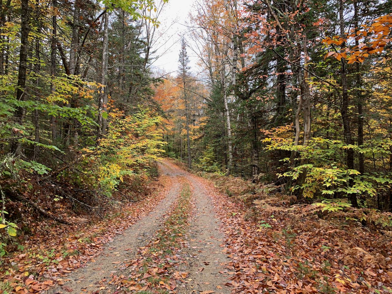
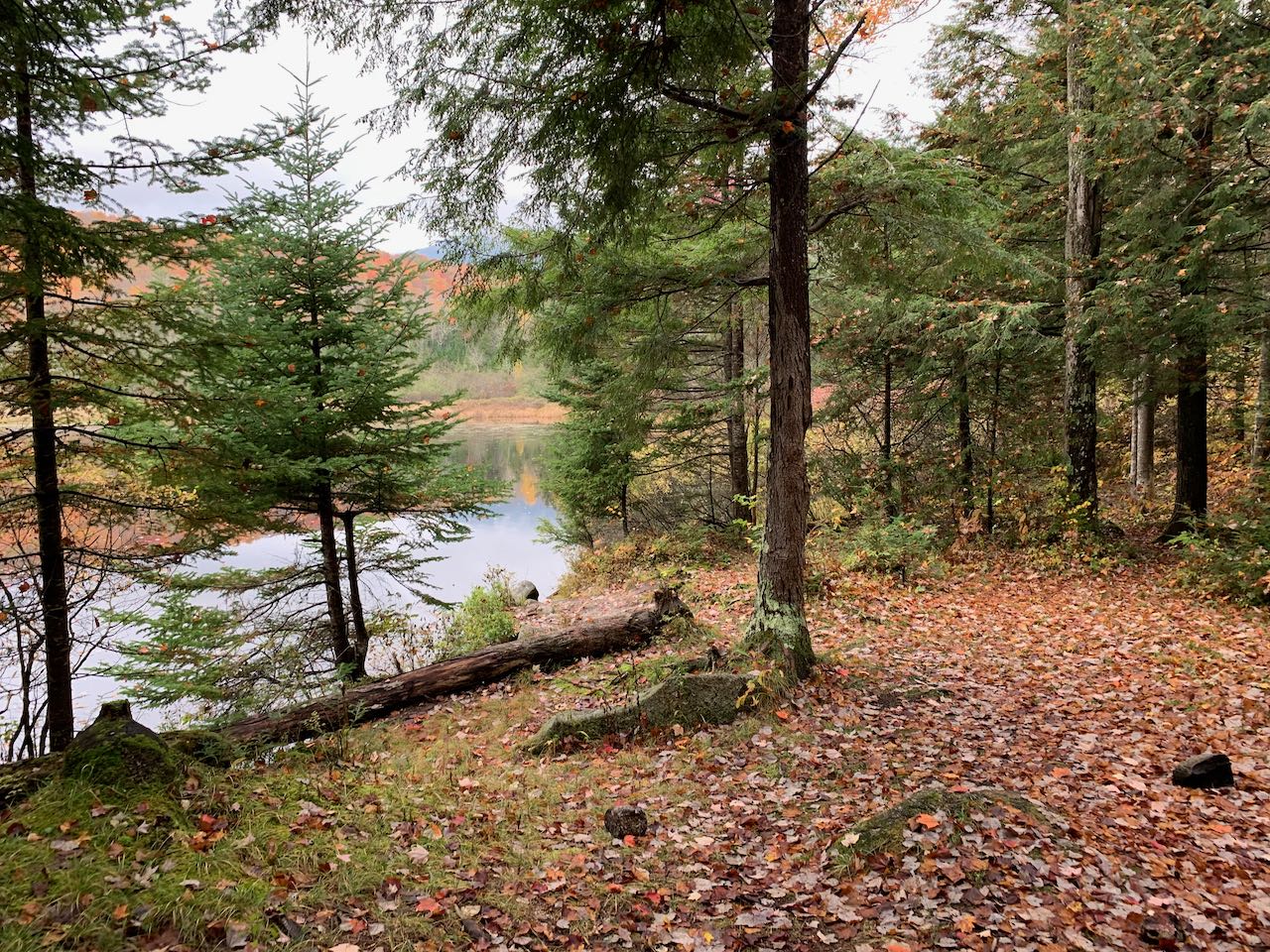
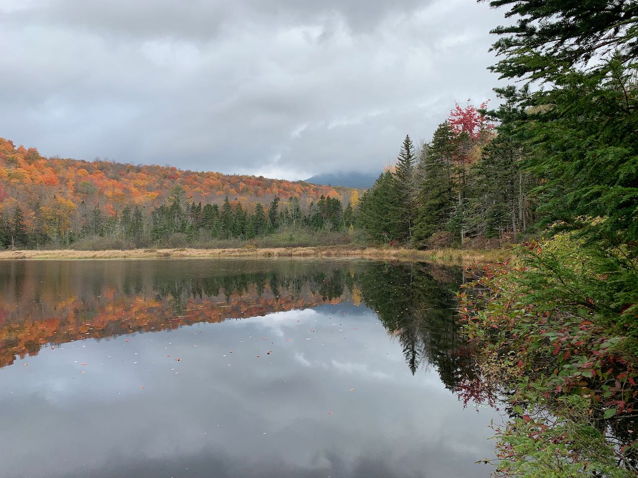
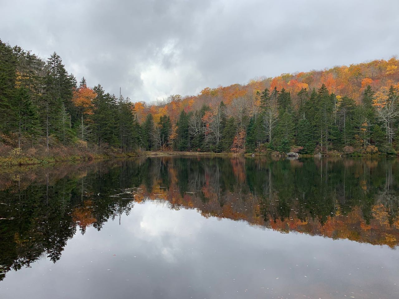
Tucked away in a secluded sector of the White Mountains amongst the foothills of the Sanwich Range, Kiah Pond is one of quite a number of destination waterbodies along the historic Sandwich Notch Road for campers and anglers. The scenic shoreline offers ample picnicking opportunities, and is especially delightful in autumn, when the foliage alight in the tree canopy illuminates the surface of the water. Waterside views include the bulky ridge of Black Mountain, leading up to Sandiwich Dome. Hiking opportunities are scant, but we recommend making the best of this by walking the 3/4 mile access road to the pond, which is pleasurable for a stroll anyway. This side road is rough for most vehicles to drive (only slightly more so than the already harrowing notch road), but is doable if you have less time to visit and want to stop by the pond on your way through. Head across Sandwich Notch Road from the parking area onto this side road. Soon crossing beneath power lines, follow its winding course through the woods, joining the pond's outlet brook and swinging around a curve to the left to arrive at the pond. The road fords the outlet brook, which though shallow, can get you wet if there's been recent rain or snowmelt. At the parking area for those who drive the road is a nice opening over the south end of the pond. The road continues unused into the woods, and a footpath leads along the shoreline between the pond and the road, coming out to a more sheltered spot with a good view.
Printable directions page